and the resultant exported shapefile looked like this (I also display roads for context)
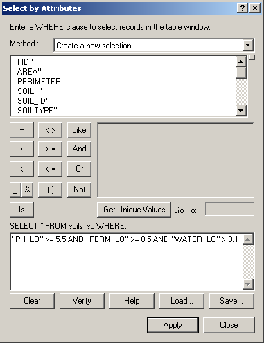
I then went ahead and queried the shapefiles to get the areas
that I wanted, going shapefile by shapefile and exporting each
selection into a new shapefile. First was the soils file...the query
was
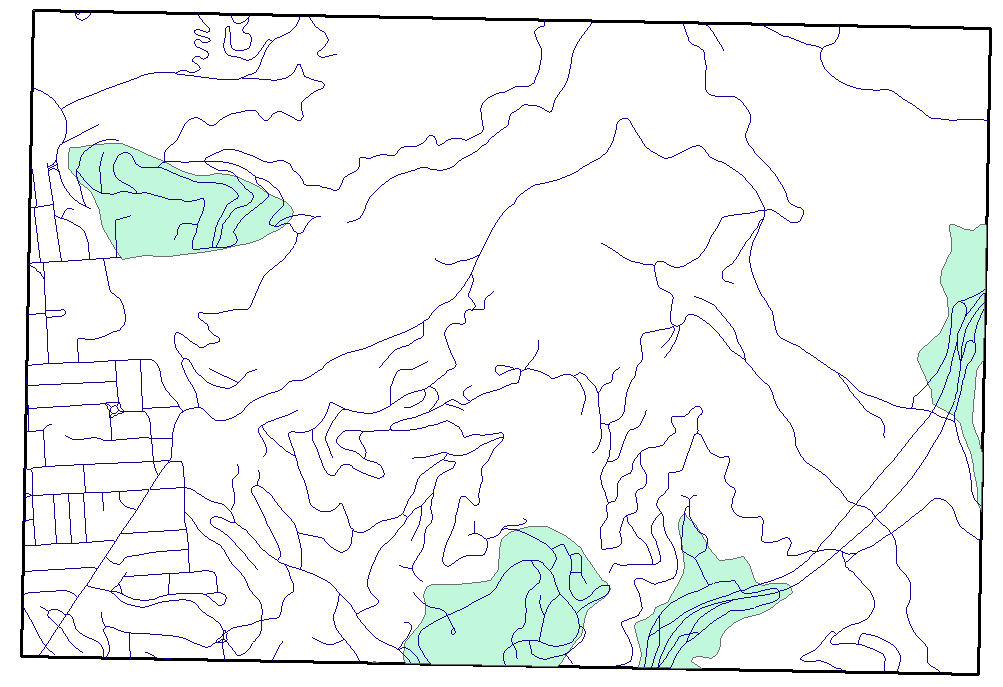
and the resultant exported shapefile looked like this (I also display
roads for context)
Next was geological slope query, as follows: 
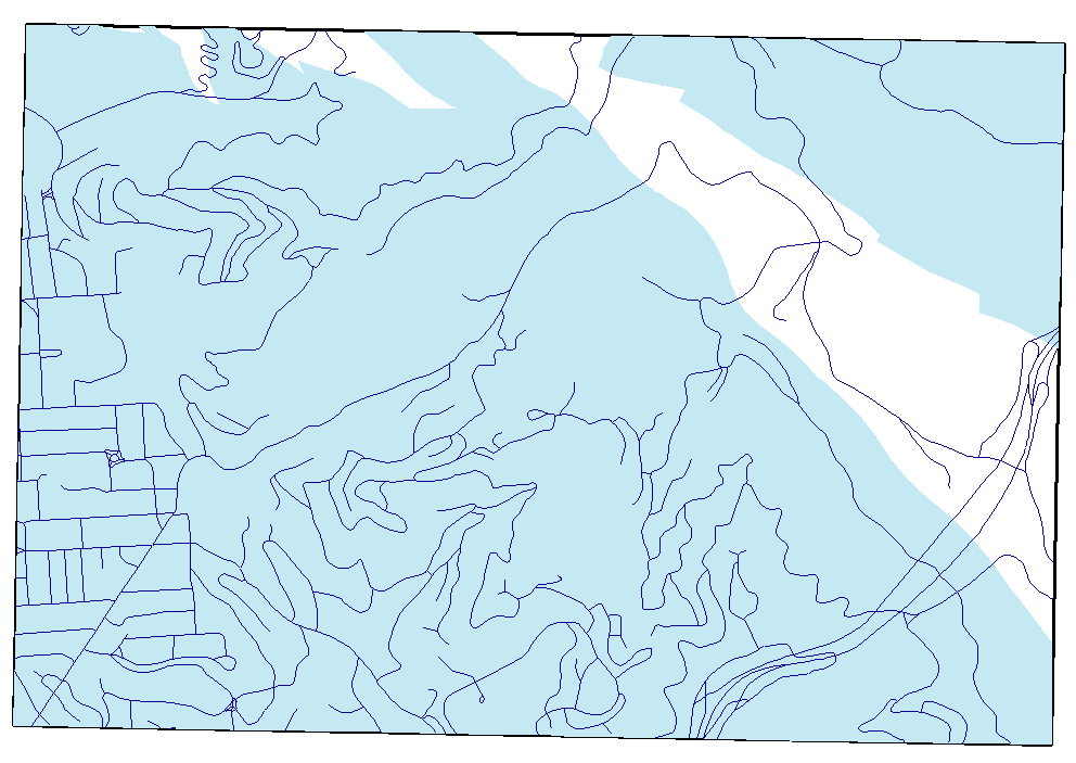
with the resultant exported shapefile looking like this:
Next was vegetation fire model and slope query, as
follows: 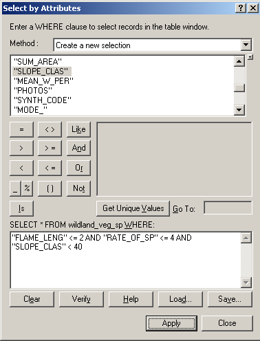
with the resultant exported shapefile looking like this:
I set these aside and then began working on buffering roads, streams, and fault lines.
First up were the roads, which I wanted to buffer in a somewhat unconventional way – I would need to first create a buffer of 40 feet, to create the undesired zone, then create another buffer of 250 feet, creating the desired zone, and then somehow cut the 40-foot buffer out of the 250-foot buffer, leaving a buffer of 40-250 feet around all roads.
Without worrying as to how I would combine the two separate
buffers to make a third, I went ahead and created the first two
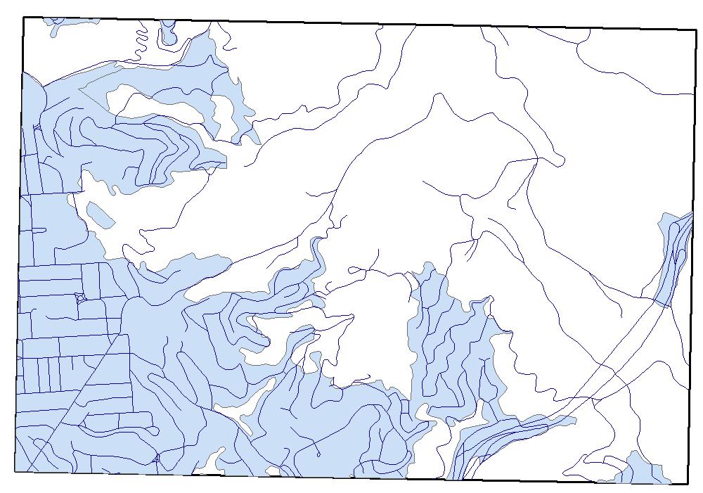
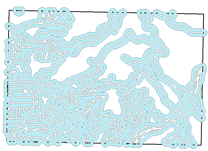
buffers, with the following combined results (this map shows roads, the
40-ft buffer, and the 250-ft buffer):
I then poked around in the Analysis tools to see if I could
find one that would do the trick for combining these two buffers.
Intersection wouldn't work, because the intersection of the two buffers
would simply be the smaller, 40-ft buffer. Clip suffered from the same
problem, and union would obviously just result in the larger, 250-ft
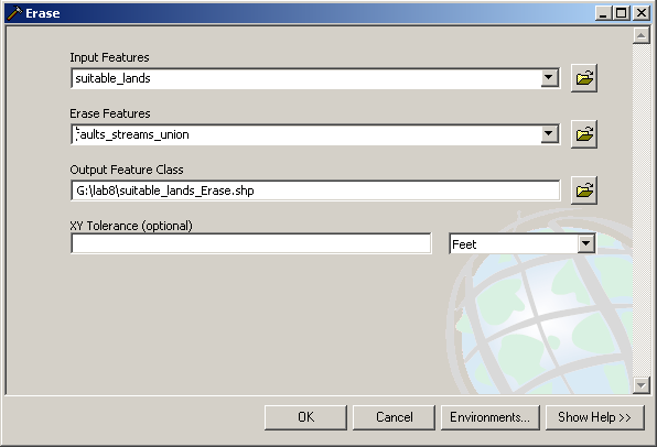
buffer. However, I found something which did exactly what I wanted
– the Erase tool: 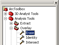 . Running the erase wizard, as
shown
here:
. Running the erase wizard, as
shown
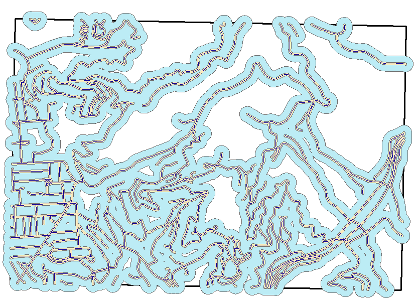
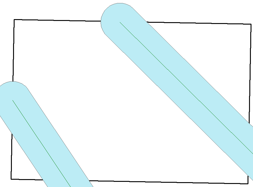
here: 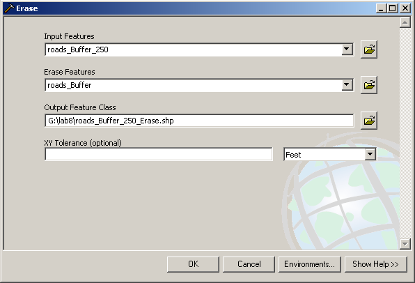 resulted
in the following map (I deactivated the roads
layer and removed the outline color for clarity).
resulted
in the following map (I deactivated the roads
layer and removed the outline color for clarity).
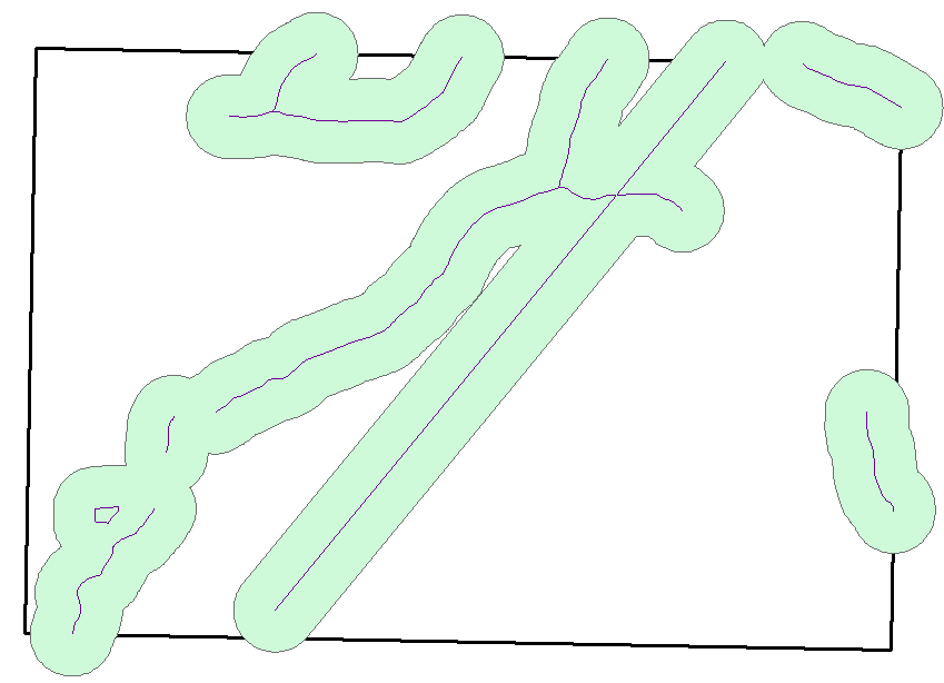
The next two buffers were much simpler: I simply buffered the
streams layer by 600 feet and the faults layer by 1000 feet, with the
following two results:
As we can see, I had two kinds of areas that dictated whether a given location was good for a house. The streams and faults were areas where a house should not be built; these were the constraints. The road buffer and soils, geology, and vegetation selections were areas where a house should be built; these were the opportunities. In addition, the house should be in areas that belong to all 4 of the latter group. The final, "perfect" locations for a house would be in the second group erased by the first, i.e. those areas that were in the second group and were not in the first.
Therefore, I first performed a union operation on the stream
and fault line buffer, resulting in the following map:
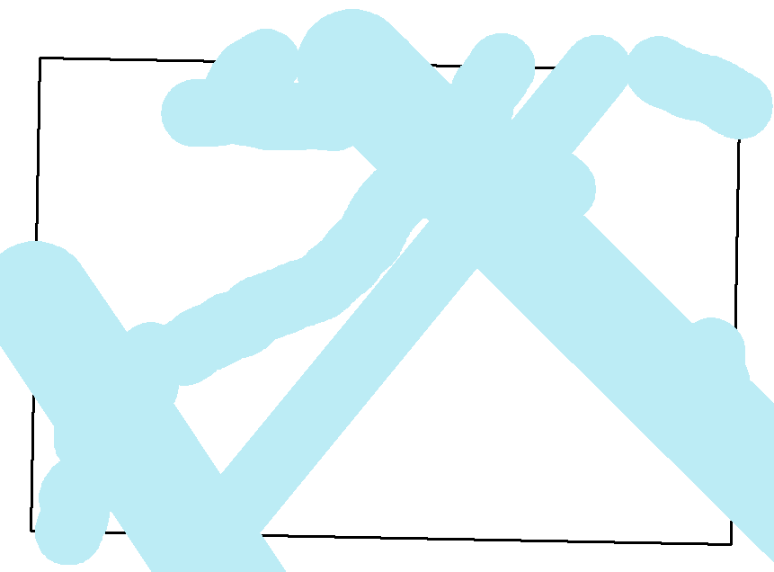
I then went ahead and intersected all of the features in the second
group (that is, road buffer and soils, geology, and vegetation
selections), resulting in the following map:
Displaying the two layers on the same map gave me the suspicion that in
reality, the streams and fault lines would not be the constraining
factors and that the biggest constraint was the soils selection
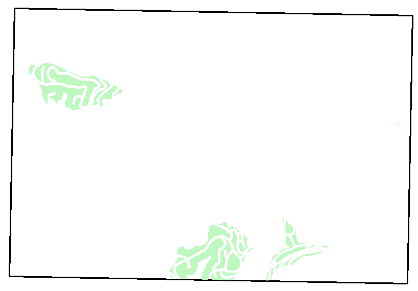
instead. Regardless, I went ahead and performed the erase operation on
the two groups:
As suspected, this didn't change the map at all.
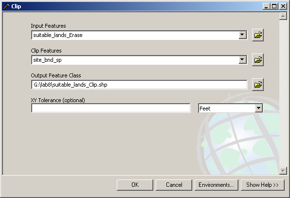
I then went ahead and performed a clip operation on the final,
"suitable housing area" shapefile to make sure that it was entirely
inside the study boundary, as follows:
I then added a digital ortho quad as a backdrop, added the roads layer
with a yellow color for the lines, and applied a 30% transparency to
the suitable housing area layer, which was white-filled and
boundary-less. The final result looks like this:
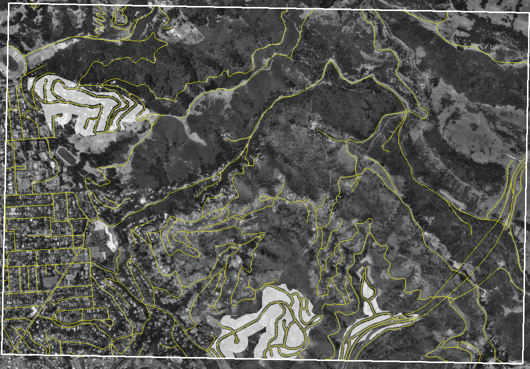
The white, semi-transparent areas on the map are "ideal" places to
build a home in the Claremont Canyon.