Lab 13
Jump to Lab assignment –
Wetlands search –
Metadata entry –
Exported metadata webpages
Lab assignment
Searching clearinghouses
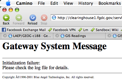
I was unable to connect to the NSDI Clearinghouse search page at all. When I clicked on the Search Clearinghouse sites using (Does not use Java applet)
, I got the following page:
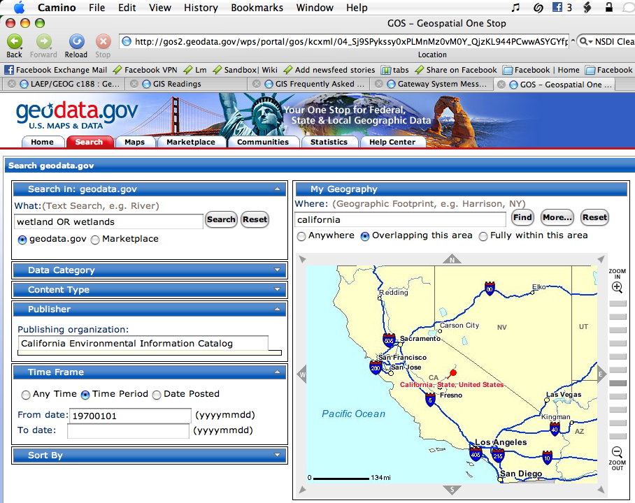
After some reading, I found out that this system was the "legacy" system and that Geodata.gov was supposed to be its replacement. I went ahead and tried doing a similar search there...with no success. First minor quirk turned out to be that you have to specify both a "From" and a "To" date when limiting the data's timeframe. The major quirk, however, was that neither of the two agencies desired – CA Environmental Information Catalog (CEIC) nor the Geography Network – were available as "Publishing organizations." Consequently, running this search gave no results:
Working with metadata
One has to be careful about importing metadata into ArcCatalog. You have to make sure to first choose the "Format" as "FGDC CSDGM (TXT)", and only then should you browse for the file. Otherwise, ArcCatalog will actually change the selected filepath to include the ".txt" extension and the import will fail miserably.
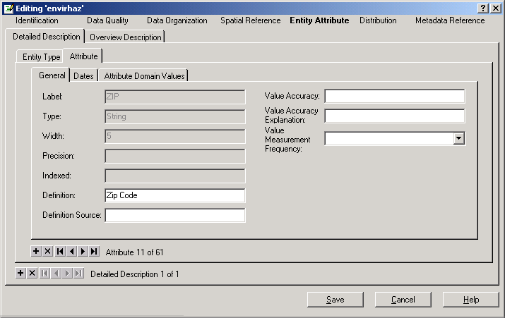
There were multiple ZIP fields in the attribute list – ZIP, ZIP_1, Zip, and Zip. Here are screenshots of all of them, showing their descriptions and values:
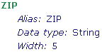
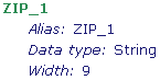
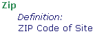

When it came time to change them, consequently, I wasn't sure what to do. I ended up leaving the second two fields as is, and adding the "Zip Code" description to the first two.
Wetlands search
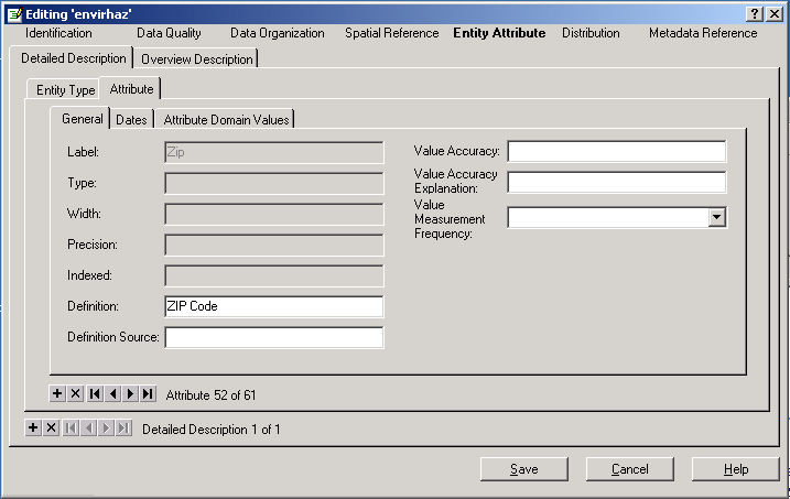
As mentioned above, I couldn't get NSDI to work properly. The ESRI Geography Network had a very appealing and simple interface. I was able to quickly perform a query:

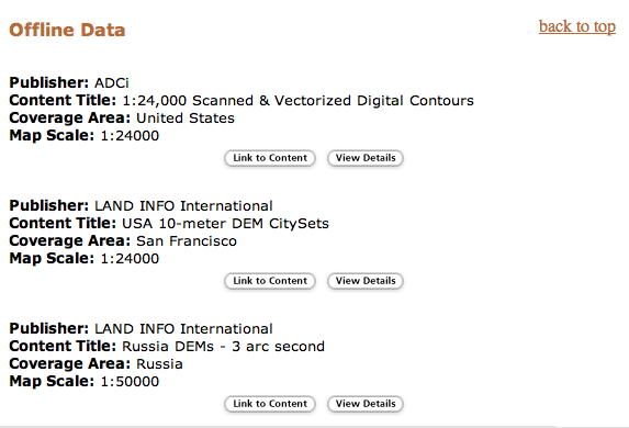
and quickly got a bunch of results. It was nice to see a quick overview of the number of hits broken down by data category. The "Live Data and Maps" section was very cool, immediately linking me to a web-based GIS browsable and queryable right through my web browser. Returning to the results from this view was as simple as cliking the "search" tab at the top of the page.
Oddly enough, finding the data that drove this GIS was basically impossible (or at least not direct in any way). However, there was also some erroneous data. For example, one of the results was from "LAND INFO International" and consisted of DEMs for Russia. I have no idea why this was even part of the returned result.
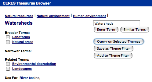
The CEIC pages, on the other hand, had a much less appealing user-interface, and a somewhat "archaic" search mechanism, but presented more relevant data and in larger quantities. The search interface seemed very outdated – first off, clicking on the "Look for data"/"By Keyword" link brings you to a page titled "CERES Thesaurus Browser", which seems a little strange. Second, searching for wathershed
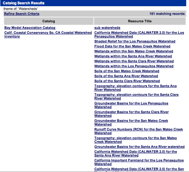
gave no results, but using the "similar terms" button gave the option of using watersheds
, which returned 161 results. Also, even after searching for "watersheds", one must click through a second page, which offers some "broader" and "related" terms. This is a bit confusing, since the button to continue is labeled "Query on Selected Themes", yet the "watersheds" theme is technically not selected anywhere (as a checkbox) on the page.
What I liked about the results page was that it was sorted by "catalog" (or publisher) of the data, and clicking on any particular item provided much more detailed information about the data than for Geography Network results. This can probably be explained by the fact that as government-produced data, the FGDC standard is used.
Metadata entry
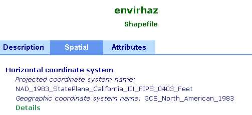
I added the appropriate projection to the shapefile:
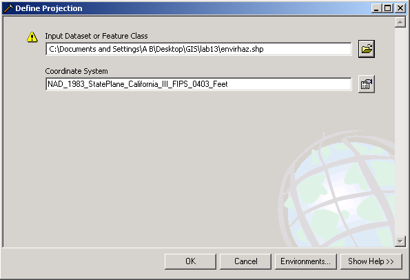
which could be evidenced by the presence of additional spatial metadata for the shapefile:
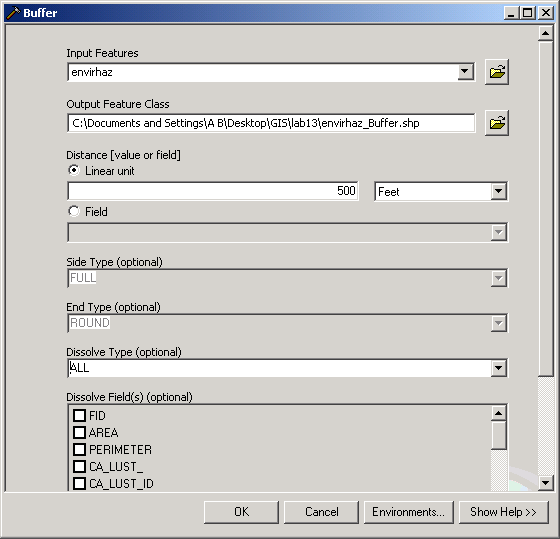
I then performed the buffer operation. Of note, a number of fields were disabled (though none that affected my work) in the Student version of the software compared to the "Full" license:
Back in ArcCatalog, it turned out that ArcMap, when creating the buffered shapefile, actually prefilled its metadata with that of the original shapefile. However, when I tried to "cut" some text which was part of the abstract in ArcCatalog, it froze. After restart, everything seemed to work OK.
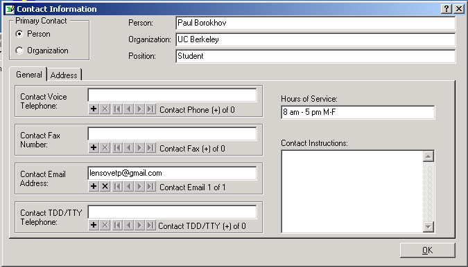
Changing the Contact info required clicking "Details..." to get a more complicated and detailed contact info form. I filled in my info, then removed all non-related info (like phone numbers and mailing address) like this:
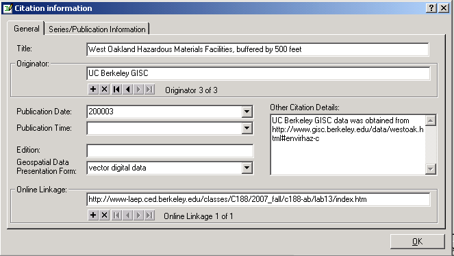
For the citation section, I went ahead and entered the detailed view and added the URL for this lab's webpage in the "Online linkage" field (sounds like a very slang name) and provided a link to the original shapefile webpage in the "Other citation details" field. I also added UC Berkeley GISC as a data originator.
The Entity Attribute > Detailed Description > Entity Type > Definition field was already prefilled by ArcMap, and I filled in the fields under Distribution > General as appropriate.
Exported metadata webpages
West Oakland Hazardous Materials Facilities
This data set locates envrionmental hazards: hazardous materials facilities, leaking storage tanks, and superfund sites. Assumption for all three types is that the further away from site, the less potential or existing hazard; distances measured from point at assumed center of site.
Complete metadata for this dataset...
West Oakland Hazardous Materials Facilities, buffered by 500 feet
This data set is based on the West Oakland Hazardous Materials Facilities dataset provided by UC Berkeley GISC. It is the result of creating 500-ft fully-dissolved buffers around the hazardous sites of the original dataset.
Complete metadata for this dataset...
back to Paul
Borokhov – Section
101 – 07
Students – C188 home