Lab 12
Jump to Lab assignment –
Assignment
Lab assignment
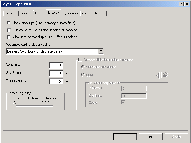
Since I was doing the assignment at home through Virtual PC, the software performance was far from stellar. As a result, for doing the georeferencing itself, I set the display quality for the raster to "Coarse" - this sped up rendering speed significantly.
I also looked into the display table and noticed that there were a bunch of different transformations that could be applied.
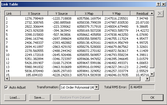
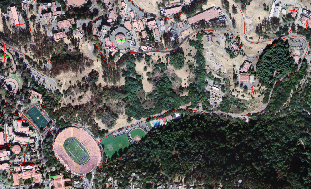
Since I had a significant number of data points, I picked "Adjust" as the transformation, resulting in the minimum RMS (root-mean-square) error. However, a part of the photo looked clearly off after this adjustment. I went ahead and added another georeferencing point to fix the issue and all was well. This was the result:
For some reason, attempts to eliminate the black border did not succeed, despite the fact that I've been able to do this many times before in other labs. ArcMap then froze so I decided to call it a day and start on the assignment.
Assignment
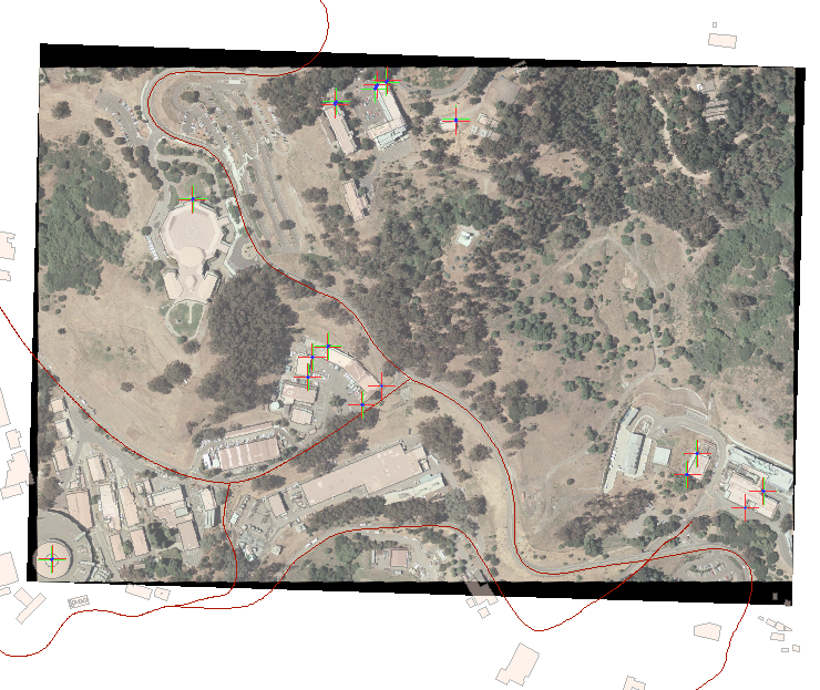
In doing the assignment, I tried to add a significant number of points in various locations around the map. I also made sure that whenever I referenced a building, I got more than one corner to make the shapefile match the photo as closely as possible. After doing a number of references, there were already gaps between the "target" and "actual" locations as the software tried to fit the photo to all of the points.
I would take a section of the photo and add a bunch of references to the buildings in it. Then, I would zoom out to full extent and see where data did not match up properly (I also used roads for reference). I'd zoom to that location and georeference some buildings there. Zoom to full view, and perform the process again. Then, when all seemed fairly properly connected, I also made sure that each map corner, as well as the center, had some reference points for optimum accuracy. At the end of it all, my link table looked like this:
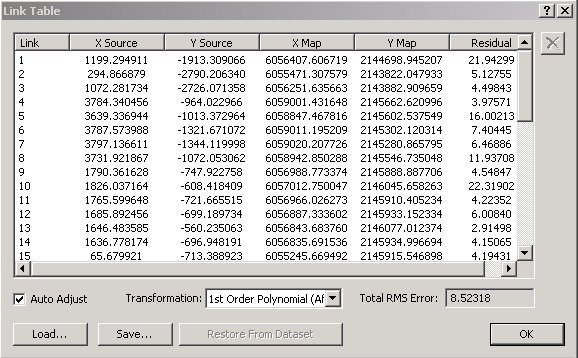
and the first order transform looked like this:
Since the total RMS error here was 8.5, I was playing around with the different transforms to see if I could bring it down (and have a more accurately referenced picture), and accidentally chose Spline as the transform type. This caused ArcMap to start calculating the spline transform, which took absolutely forever. Again, the antiquity of the software boggled me as there was no way to stop this computationally-intensive application short of force-quitting the program. I went on a tour of the Scharffen Berger chocolate factory and left my computer alone to see if ArcMap could at least finish the operation in a few hours...
Unfortunately, even after ArcMap was left alone for almost 7 hours, there was still no visible progress...though the little globe icon at the bottom was still spinning:
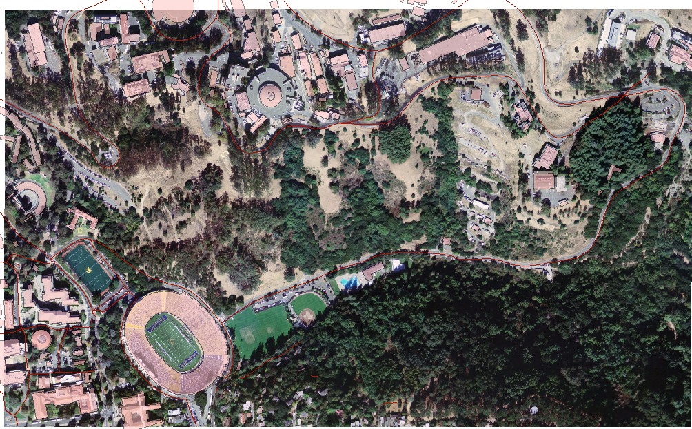
Thankfully, I had saved my ArcMap document just before opening the link table to adjust the transformation being applied. I'm not really sure exactly what goes on behind the scenes, but when you then reopen the document, the georeferencing crosshairs and points are all gone, but the photo is still georeferenced, in the same way that it was the last time you saved it. Here's what my final map looked like after the reopening of the file:
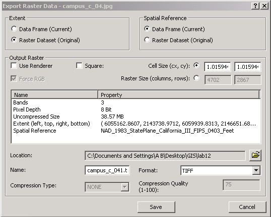
I then went ahead and performed the export to TIFF operation:
...to get the image which can be downloaded here.
back to Paul
Borokhov – Section
101 – 07
Students – C188 home