Jump to Chosen factors – Calculating constraints – Calculating opportunities – Final result
First, it was important to come up with a reasonable set of constraints and opportunities that would help us pinpoint the locations that would be suitable for the solar arrays. The constraints deal mainly with unstable soils, since solar arrays are expensive investments that we would not want to be destroyed during the next rainstorm. The opportunities deal mainly with especially favorable locations.
The solar installation should not be located on:
These factors affect soil and structural stability and therefore it would not be wise to construct a solar installation land with such factors. The solar panels should also not be constructed:
These factors affect fire safety and are designed to minimize the amount of damage suffered by the installation in the case of a wildfire. The buffer values are the means of the available data for the factors.
A number of factors are favorable for solar installations. Namely, the solar installation can be built on:
With these factors in place, it came time to perform the geographic analyses and queries necessary to find the suitable sites.
First, we find the geologies with POOR slopes. Performing the appropriate query, we see this result:
Then we buffer streams by 600 feet:
Then we buffer faults by 400 feet:
Then we find soils with low permeability and high K erosion factors:
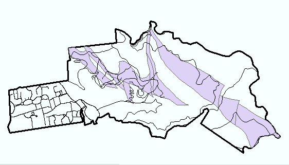
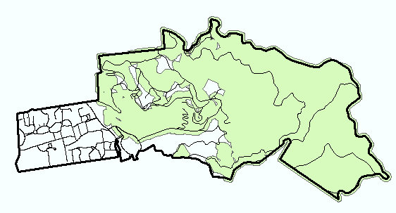
For simplicity and ease of analysis, I then UNIONed these four layers to get the following:
Finally, we buffer landslides by 50 feet to get this map:
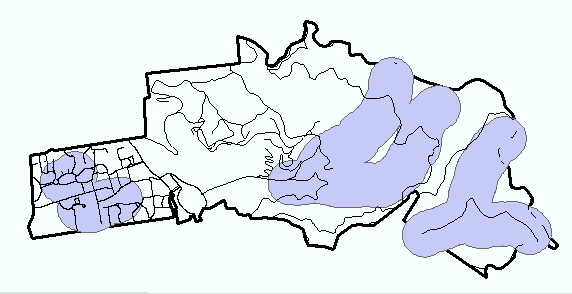
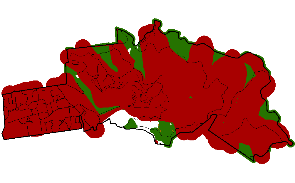
Next, we move on to the fire models. We first buffer areas with flame lengths of greater than 10 feet by 50 feet:
Then, we buffer areas with rates of spread greater than 5 feet/min by 100 feet
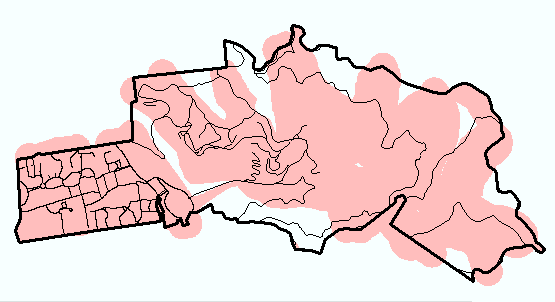
We now combine all these contraints to get the following:
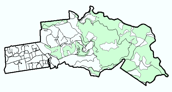
We now move to the opportunities aspect of the project.
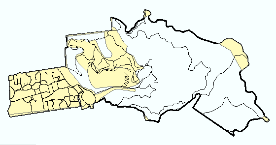
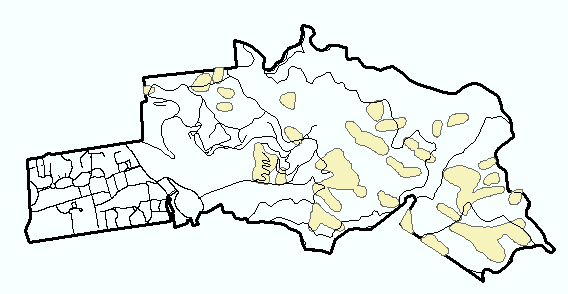
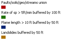
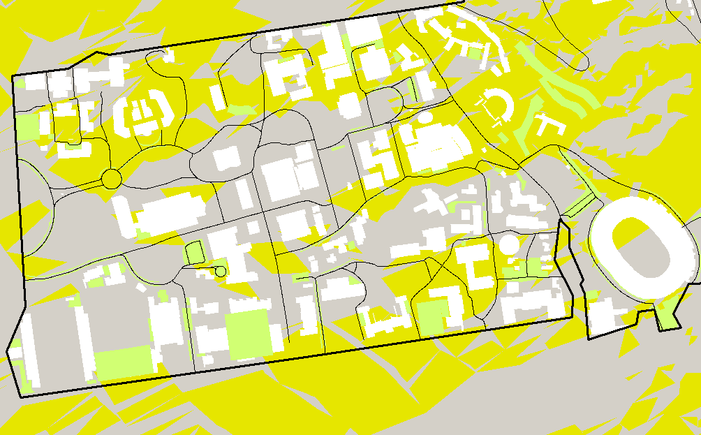
We first preform an aspect analysis on a TIN generated from contour data. Then, we reclassify the data and show in yellow only the directions we are interested in: between 121 and 240 degrees.
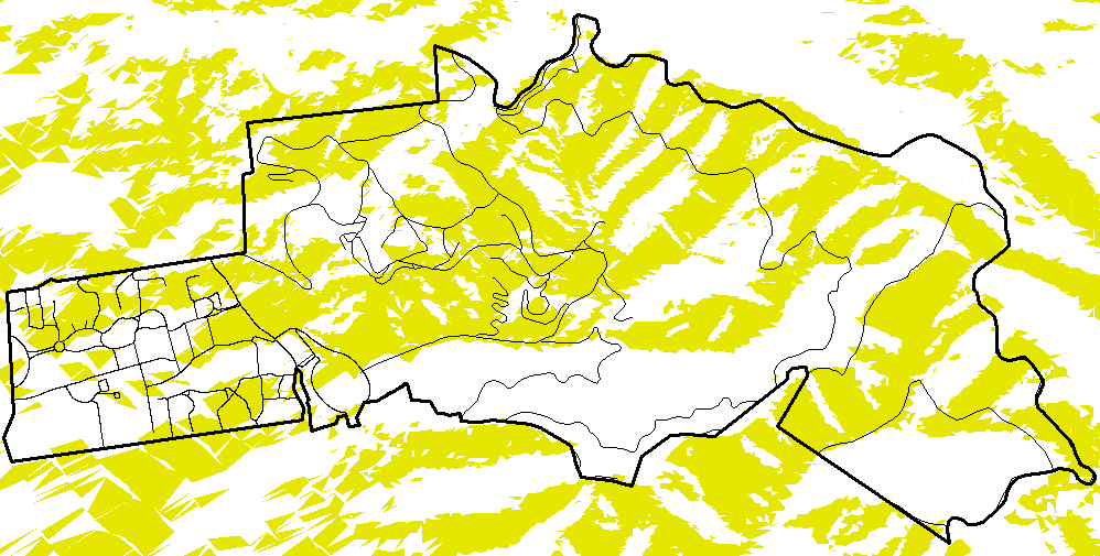
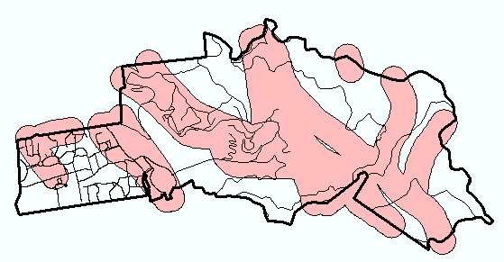
When we overlay over previous constraints with this data, we see that of the little suitable land which remained after the enforcement of the constraints, only tiny portions fall within the desired aspect values:
Note how little yellow can be seen within the campus boundary.
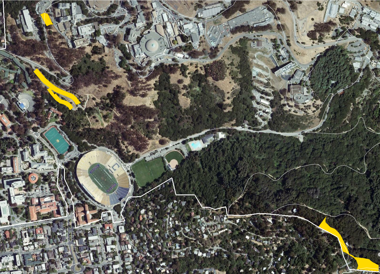
To resolve this, I then studied potential buildings and parking lots, using aerial photography as an aid. Since land west of the Memorial Stadium is already developed, soil permeability might be low (this is certainly the case on a parking lot), but that is OK in this scenario. Consequently I zoomed in on the western part of campus, looking at buildings, parking lots, and desirable aspect:
The buildings are in white, the parking lots in green, and the desirable aspect in yellow. It was now time to put everything together and pick the final three sites.
The analysis of the western part of campus led me to pick the parking lot by Stern Hall is a suitable site for a solar installation. It has good aspect and the solar arrays could provide shade to the cars on the lot.
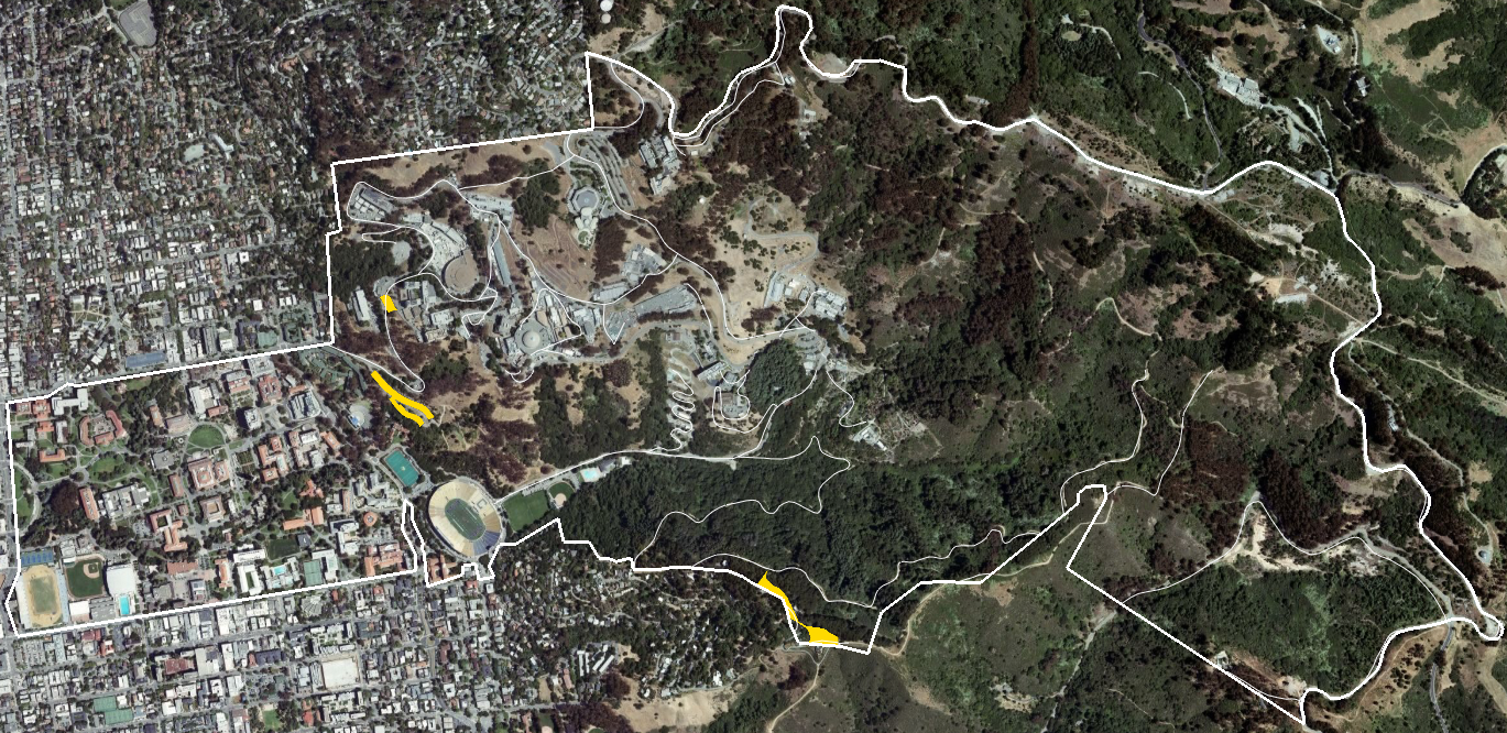
I then found two more sites in the eastern portion of campus. One of the sites does not have very favorable aspect and is currently (according to aerial imagery at most 2 years old) covered with trees. The other has little vegetation and over half has a favorable aspect. I then created polygons for these desirable sites and imported them into Google Earth.
This image shows the favorable sites in a golden color, with the campus boundary and campus roads in white:
This image is zoomed to the favorable sites for a slightly better idea of their actual locations:
The final shapefile and KML and KMZ files are all zipped together in this archive.